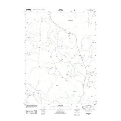
2012 Map of Adin Pass
USGS Topo · Published 2012About this map
Adin Pass serves as a critical geographic transition in this high-altitude corner of Modoc County, where mountain ridges and expansive flats define the landscape. The northern reaches are dominated by Schaffer Mountain and the headwaters of Stone Coal Cr, while the southern terrain breaks into deep drainages like Dutch Flat Canyon and Cox Canyon. Numerous water sources, including Harris Spring and Antelope Spring, suggest a landscape historically shaped by livestock grazing and seasonal use. The presence of Lower Rush Creek Campground along Rush Cr indicates the area's role as a recreation corridor. Evidence of the region's managed timber and forest resources is clear from the network of numbered routes such as 41n11 and 40n22, which connect isolated areas like The Cliffs and Rice Flat to the broader California wilderness.
Find a feature on this map
79 named features on this map. Tap any name to fly to it.
Don’t see what you’re looking for? This feature index may not catch every label — zoom into the map to look around manually.
Map Details
Editions of this 2012 Adin Pass Map
This is the sole edition of this map. No revisions or reprints were ever made.
Other maps of this area

1886 · Alturas
USGS Topo · 1:250,000

1886 · Modoc Lava Bed
USGS Topo · 1:250,000

1892 · Modoc Lava-Bed
USGS Topo · 1:250,000

1892 · Alturas
USGS Topo · 1:250,000

1954 · Alturas
USGS Topo · 1:250,000

1958 · Alturas
USGS Topo · 1:250,000

1961 · Canby
USGS Topo · 1:62,500

1961 · Bieber
USGS Topo · 1:62,500

1962 · Alturas
USGS Topo · 1:250,000

1962 · Crank Mountain
USGS Topo · 1:62,500