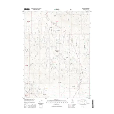
2015 Map of Adin Pass
USGS Topo · Published 2015About this map
Lost Cabin Mine sits tucked within the western slopes of the Modoc National Forest, a reminder of the prospecting history in this corner of Northeastern California. The landscape is defined by its transition from high summits like Schaffer Mtn and Grouse Mountain down toward the open expanse of Round Valley and the prominent escarpment known as The Cliffs. Transportation in this area is characterized by an intricate network of spurs and tracks, such as Adin Pass and Thompson Terrace, which provide access to numerous water sources including Niles Spring, Rice Spring, and Hoskins Spring. These high-country flats, notably Roney Flat and Rice Flat, once served as crucial points for seasonal movement and grazing. The topography is deeply carved by drainage systems like Dutch Flat Canyon and Niles Canyon, illustrating the complex watershed that feeds the northern California interior.
Find a feature on this map
71 named features on this map. Tap any name to fly to it.
Don’t see what you’re looking for? This feature index may not catch every label — zoom into the map to look around manually.
Map Details
Editions of this 2015 Adin Pass Map
This is the sole edition of this map. No revisions or reprints were ever made.
Other maps of this area

1886 · Alturas
USGS Topo · 1:250,000

1886 · Modoc Lava Bed
USGS Topo · 1:250,000

1892 · Modoc Lava-Bed
USGS Topo · 1:250,000

1892 · Alturas
USGS Topo · 1:250,000

1954 · Alturas
USGS Topo · 1:250,000

1958 · Alturas
USGS Topo · 1:250,000

1961 · Canby
USGS Topo · 1:62,500

1961 · Bieber
USGS Topo · 1:62,500

1962 · Alturas
USGS Topo · 1:250,000

1962 · Crank Mountain
USGS Topo · 1:62,500