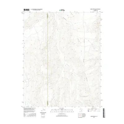
2016 Map of Adobe Creek SE
USGS Topo · Published 2016About this map
White Deer Cr and the drainages of Reynolds Cr define this landscape along the eastern edge of Hutchinson Co. This 2016 survey provides a clear view of the deep ravines and complex topography that characterize the region. The map shows the Hutchinson Co and Roberts Co line as it bisects the northern panhandle plains, a region largely defined by expansive ranching operations and water access. Morrison Ranch Rd provides the primary transit artery through the eastern portion of the quadrangle, tracing the higher ground between the branching systems of the W Fork Reynolds Cr. The lack of dense settlement emphasizes the land's continuing role as active ranching territory, where terrain features like these creek beds remain the primary landmarks.
Find a feature on this map
5 named features on this map. Tap any name to fly to it.
Don’t see what you’re looking for? This feature index may not catch every label — zoom into the map to look around manually.
Map Details
Editions of this 2016 Adobe Creek SE Map
This is the sole edition of this map. No revisions or reprints were ever made.
Other maps of this area

1954 · Amarillo
USGS Topo · 1:250,000

1958 · Amarillo
USGS Topo · 1:250,000

1971 · Skellytown NW
USGS Topo · 1:24,000

1971 · Dry Creek South
USGS Topo · 1:24,000

1971 · Skellytown NE
USGS Topo · 1:24,000

1971 · Adobe Creek SW
USGS Topo · 1:24,000

1971 · Dry Creek North
USGS Topo · 1:24,000

1971 · Pampa NW
USGS Topo · 1:24,000

1971 · Garden Springs
USGS Topo · 1:24,000

1971 · Adobe Creek SE
USGS Topo · 1:24,000