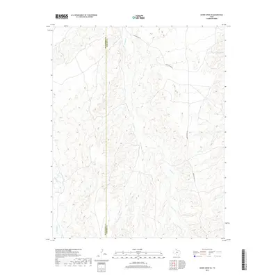
2019 Map of Adobe Creek SE
USGS Topo · Published 2019About this map
The Hutchinson Co Roberts Co boundary line divides this Texas Panhandle landscape, where the drainage systems of the Canadian River basin define the local topography. The map detail centers on the winding course of Reynolds Creek and its tributary, W Fork Reynolds Creek, which carve through the high plains. Ranching infrastructure is represented by Morrison Ranch Rd, the primary artery through this sparsely populated territory. In the southwest corner, the headwaters of White Deer Creek emerge, providing a clear view of the water-driven geography that has dictated land use and property lines in this region for generations.
Find a feature on this map
5 named features on this map. Tap any name to fly to it.
Don’t see what you’re looking for? This feature index may not catch every label — zoom into the map to look around manually.
Map Details
Editions of this 2019 Adobe Creek SE Map
This is the sole edition of this map. No revisions or reprints were ever made.
Other maps of this area

1954 · Amarillo
USGS Topo · 1:250,000

1958 · Amarillo
USGS Topo · 1:250,000

1971 · Skellytown NW
USGS Topo · 1:24,000

1971 · Dry Creek South
USGS Topo · 1:24,000

1971 · Skellytown NE
USGS Topo · 1:24,000

1971 · Adobe Creek SW
USGS Topo · 1:24,000

1971 · Dry Creek North
USGS Topo · 1:24,000

1971 · Pampa NW
USGS Topo · 1:24,000

1971 · Garden Springs
USGS Topo · 1:24,000

1971 · Adobe Creek SE
USGS Topo · 1:24,000