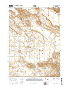
2017 Map of Adobe Flat
USGS Topo · Published 2017About this map
Adobe Flat lies in a desert landscape defined by high buttes and intermittent water sources. This 2017 survey shows the sparse infrastructure of the region, where Anderson Valley Rd and Coon Town Rd provide access through the sagebrush and basin terrain. Topographic landmarks like Hatt Butte, Kegler Butte, and Davison Butte rise above the flats, providing essential points of orientation for those navigating the wide-open spaces between Virginia Valley and Anderson Valley.
Find a feature on this map
19 named features on this map. Tap any name to fly to it.
Don’t see what you’re looking for? This feature index may not catch every label — zoom into the map to look around manually.
Map Details
Editions of this 2017 Adobe Flat Map
This is the sole edition of this map. No revisions or reprints were ever made.
Other maps of this area

1955 · Burns
USGS Topo · 1:250,000

1958 · Burns
USGS Topo · 1:250,000

1959 · Burns
USGS Topo · 1:250,000

1960 · Crane
USGS Topo · 1:62,500

1967 · Happy Valley
USGS Topo · 1:24,000

1967 · Barton Lake
USGS Topo · 1:24,000

1967 · Diamond
USGS Topo · 1:24,000

1967 · Adobe Flat
USGS Topo · 1:24,000

1968 · Venator
USGS Topo · 1:62,500

1972 · Circle Bar
USGS Topo · 1:24,000