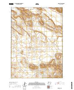
2020 Map of Adobe Flat
USGS Topo · Published 2020About this map
Adobe Flat characterizes this portion of Harney County, where the high desert terrain is punctuated by prominent volcanic features like Hatt Butte, Kegler Butte, and Davison Butte. The landscape is defined by its drainage patterns and water management, visible in the seasonal Kegler Lake and the engineered Dracatos Reservoir. The map illustrates a sparse but deliberate network of high-plateau roads, including Anderson Valley Rd and Coon Town Rd, which provide access through the broad depressions of Virginia Valley and Anderson Valley. The presence of Dracatos Draw and Standcliff Cr suggests the critical importance of water movement in this arid environment. Significant natural landmarks such as Malheur Gap provide clear geographic markers for researchers tracing the topographic character of this remote region of southeastern Oregon.
Find a feature on this map
18 named features on this map. Tap any name to fly to it.
Don’t see what you’re looking for? This feature index may not catch every label — zoom into the map to look around manually.
Map Details
Editions of this 2020 Adobe Flat Map
This is the sole edition of this map. No revisions or reprints were ever made.
Other maps of this area

1955 · Burns
USGS Topo · 1:250,000

1958 · Burns
USGS Topo · 1:250,000

1959 · Burns
USGS Topo · 1:250,000

1960 · Crane
USGS Topo · 1:62,500

1967 · Happy Valley
USGS Topo · 1:24,000

1967 · Barton Lake
USGS Topo · 1:24,000

1967 · Diamond
USGS Topo · 1:24,000

1967 · Adobe Flat
USGS Topo · 1:24,000

1968 · Venator
USGS Topo · 1:62,500

1972 · Circle Bar
USGS Topo · 1:24,000