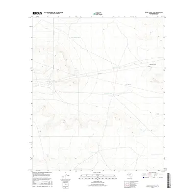
2016 Map of Adobe House Tank
USGS Topo · Published 2016About this map
Adobe House Tank is the namesake of this Hudspeth County quadrangle, situated in a landscape defined by seasonal water management and dry drainages. Recorded during a mid-2010s survey, the map details a network of earthen reservoirs such as Cinco De Mayo Tank, Llano Tank, and Tonto Tank that support ranching in this arid corner of West Texas. These features illustrate the vital infrastructure required for livestock survival in a region where natural springs are rare. Human transit is limited to the single thoroughfare of Ranch Rd 2317, which cuts across the terrain. Large-scale topographic depressions like University Draw and Antelope Draw channel infrequent runoff through the scrubland, marking the primary natural features of the territory south of the New Mexico border.
Find a feature on this map
11 named features on this map. Tap any name to fly to it.
Don’t see what you’re looking for? This feature index may not catch every label — zoom into the map to look around manually.
Map Details
Editions of this 2016 Adobe House Tank Map
This is the sole edition of this map. No revisions or reprints were ever made.
Other maps of this area

1903 · Cerro Alto
USGS Topo · 1:125,000

1943 · Tepee Butte
USGS Topo · 1:62,500

1943 · San Antonio Mtn
USGS Topo · 1:62,500

1951 · Red Hills
USGS Topo · 1:62,500

1954 · Van Horn
USGS Topo · 1:250,000

1955 · Cerro Diablo
USGS Topo · 1:62,500

1958 · Van Horn
USGS Topo · 1:250,000
1978 · Granite Mountain
USGS Topo · 1:24,000
1978 · Molesworth Mesa South
USGS Topo · 1:24,000
1979 · Molesworth Mesa North
USGS Topo · 1:24,000