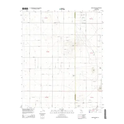
2015 Map of Adobe Mountain
USGS Topo · Published 2015About this map
The high desert landscape of the Mojave Desert defines this section of the Los Angeles and San Bernardino border, where an intricate grid of rural roads meets the natural topography of the El Mirage Valley. Dominating the central portion is Adobe Mtn, surrounded by a network of local thoroughfares such as Shadow Mountain Rd and Adobe Mountain Rd that suggest a pattern of sprawling residential and ranching interest. To the south, the terrain descends toward the seasonal El Mirage Lake and the drainage of Eller Slough. This region reflects a specific moment in California's desert development, where aviation interests like Hansen Airport are situated alongside rugged landmarks such as Nash Hill and Gray Mtn, highlighting the intersection of transit and the arid environment.
Find a feature on this map
56 named features on this map. Tap any name to fly to it.
Don’t see what you’re looking for? This feature index may not catch every label — zoom into the map to look around manually.
Map Details
Editions of this 2015 Adobe Mountain Map
This is the sole edition of this map. No revisions or reprints were ever made.
Other maps of this area

1930 · El Mirage
USGS Topo · 1:24,000

1930 · Wilsona
USGS Topo · 1:24,000

1931 · Adobe
USGS Topo · 1:24,000

1931 · Hi Vista
USGS Topo · 1:24,000

1933 · El Mirage
USGS Topo · 1:24,000

1934 · Adobe
USGS Topo · 1:24,000

1935 · Hi Vista
USGS Topo · 1:24,000
1935 · Wilsona
USGS Topo · 1:24,000

1937 · Shadow Mountains
USGS Topo · 1:48,000

1937 · Kramer
USGS Topo · 1:48,000