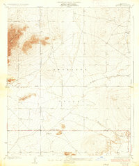
1935 Map of Wilsona
USGS Topo · Published 1935About this map
Antelope Valley dominates this high-desert landscape, captured during the mid-1930s before significant urban expansion. The small settlement of Wilsona sits at a critical junction of section roads, anchored by a series of irrigation wells and tanks that supported early homesteaders in this arid basin. To the northwest, the prominent rising profile of Saddleback Butte provides a sharp contrast to the surrounding flat terrain, serving as a permanent landmark for travelers and residents alike.
Find a feature on this map
12 named features on this map. Tap any name to fly to it.
Don’t see what you’re looking for? This feature index may not catch every label — zoom into the map to look around manually.
Map Details
Editions of this 1935 Wilsona Map
3 editions found
Other maps of this area

1930 · Joshua
USGS Topo · 1:24,000

1930 · Lovejoy Springs
USGS Topo · 1:24,000

1930 · Black Butte
USGS Topo · 1:24,000

1930 · El Mirage
USGS Topo · 1:24,000

1930 · Llano
USGS Topo · 1:24,000

1930 · Angle
USGS Topo · 1:24,000

1930 · Wilsona
USGS Topo · 1:24,000

1931 · Adobe
USGS Topo · 1:24,000

1931 · Hi Vista
USGS Topo · 1:24,000

1932 · Angle
USGS Topo · 1:24,000