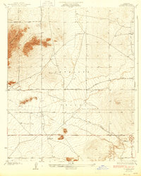
1935 Map of Wilsona
USGS Topo · Published 1935About this map
Wilsona and the surrounding expanse of the Antelope Valley appear here during a period of early 20th-century desert settlement, characterized by a burgeoning grid of rural roads and scattered water sources. The landscape is defined by the stark prominence of Saddleback Butte to the northwest and Black Butte to the south, while the hydrological pattern of the desert is revealed through features like Ellen Slough and Moody Spr. This 1930s survey, supported by data from the Los Angeles County Board of Supervisors, documents the transition of this arid region into a structured network of thoroughfares, including Avenue J and El Mirage Road. For those researching local history or genealogy, the map provides precise locations for early landmarks like several named wells and a Tank, reflecting the vital importance of water infrastructure for the homesteaders of this era.
Find a feature on this map
13 named features on this map. Tap any name to fly to it.
Don’t see what you’re looking for? This feature index may not catch every label — zoom into the map to look around manually.
Map Details
Editions of this 1935 Wilsona Map
3 editions found
Other maps of this area

1930 · Joshua
USGS Topo · 1:24,000

1930 · Lovejoy Springs
USGS Topo · 1:24,000

1930 · Black Butte
USGS Topo · 1:24,000

1930 · El Mirage
USGS Topo · 1:24,000

1930 · Llano
USGS Topo · 1:24,000

1930 · Angle
USGS Topo · 1:24,000

1930 · Wilsona
USGS Topo · 1:24,000

1931 · Adobe
USGS Topo · 1:24,000

1931 · Hi Vista
USGS Topo · 1:24,000

1932 · Angle
USGS Topo · 1:24,000