
1934 Map of Adobe
USGS Topo · Published 1934About this map
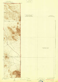
The Antelope Valley high desert landscape is captured here during a transitional phase of regional mapping, specifically showing the transition from surveyed terrain to a large Preliminary Edition Unsurveyed Area to the east. The map represents the high-desert fringe where Los Angeles County meets both Kern and San Bernardino counties, dominated by the prominent rise of Adobe Mountain in the south. The early grid system is evident through established thoroughfares like Avenue B, Avenue C, and 245 Th St. E, providing a framework for the sparse homesteading and agricultural development characteristic of this arid region during the early 1930s. This edition is particularly notable for its reliance on information furnished by the Board of Supervisors and County Surveyor J.E. Rockhold, reflecting a period when local county data was essential for filling in the blanks of federal topographic surveys.
Find a feature on this map
8 named features on this map. Tap any name to fly to it.
Don’t see what you’re looking for? This feature index may not catch every label — zoom into the map to look around manually.
Map Details
Editions of this 1934 Adobe Map
2 editions found
Other maps of this area

1930 · El Mirage
USGS Topo · 1:24,000

1930 · Wilsona
USGS Topo · 1:24,000

1931 · Adobe
USGS Topo · 1:24,000

1931 · Hi Vista
USGS Topo · 1:24,000

1933 · El Mirage
USGS Topo · 1:24,000

1935 · Hi Vista
USGS Topo · 1:24,000
1935 · Wilsona
USGS Topo · 1:24,000

1937 · Shadow Mountains
USGS Topo · 1:48,000

1937 · Kramer
USGS Topo · 1:48,000

1942 · Kramer
USGS Topo · 1:62,500