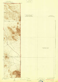
1934 Map of Adobe
USGS Topo · Published 1934About this map
Antelope Valley spreads across this 1930s survey, documenting a transitional landscape on the eastern edge of Los Angeles County. Developed from data furnished by Los Angeles County and surveyor J. E. Rockhold, the map reveals a geometric grid of early roads like Avenue B and Avenue C cutting through the high desert. The topography is dominated by the prominent rise of Adobe Mountain in the south, while the eastern portion of the sheet remains largely open, designated as a Preliminary Edition Unsurveyed Area. This record is particularly valuable for its depiction of the county line shared with Kern and San Bernardino, capturing the early infrastructure of the region before mid-century expansion.
Find a feature on this map
7 named features on this map. Tap any name to fly to it.
Don’t see what you’re looking for? This feature index may not catch every label — zoom into the map to look around manually.
Map Details
Editions of this 1934 Adobe Map
2 editions found
Other maps of this area

1930 · El Mirage
USGS Topo · 1:24,000

1930 · Wilsona
USGS Topo · 1:24,000

1931 · Adobe
USGS Topo · 1:24,000

1931 · Hi Vista
USGS Topo · 1:24,000

1933 · El Mirage
USGS Topo · 1:24,000

1934 · Adobe
USGS Topo · 1:24,000

1935 · Hi Vista
USGS Topo · 1:24,000
1935 · Wilsona
USGS Topo · 1:24,000

1937 · Shadow Mountains
USGS Topo · 1:48,000

1937 · Kramer
USGS Topo · 1:48,000