
1943 Map of Adrian
USGS Topo · Published 1962About this map
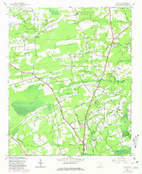
The Atlantic Coast Line railroad cuts through this rural landscape of Horry County during the early 1940s, connecting small communities like Adrian and Allen. The map reveals a highly decentralized settlement pattern typical of the era, where daily life was anchored by local institutions such as Pleasant Union Ch, Mt Aerial Ch, and a network of neighborhood schools including Poplar Hill Sch and Homewood Sch.
Find a feature on this map
51 named features on this map. Tap any name to fly to it.
Don’t see what you’re looking for? This feature index may not catch every label — zoom into the map to look around manually.
Map Details
Editions of this 1943 Adrian Map
2 editions found
Other maps of this area

1937 · Nixonville
USGS Topo · 1:48,000

1942 · Nixonville
USGS Topo · 1:62,500

1943 · Dongola
USGS Topo · 1:24,000

1943 · Horry
USGS Topo · 1:24,000

1943 · Conway
USGS Topo · 1:24,000

1944 · Adrian
USGS Topo · 1:31,680

1948 · Galivants Ferry
USGS Topo · 1:24,000

1948 · Bayboro
USGS Topo · 1:24,000

1949 · Bayboro
USGS Topo · 1:24,000

1949 · Georgetown
USGS Topo · 1:250,000