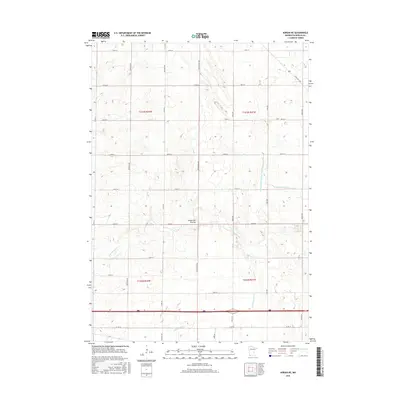
2016 Map of Adrian NE
USGS Topo · Published 2016About this map
The Coteau des Prairies plateau dominates this section of Nobles County, forming a distinct upland landscape that dictates the local drainage patterns. This agricultural region is defined by a rigorous grid of section-line roads, including Co Rd 68 and Co Rd 35, which facilitate the movement of goods across the prairie. Water management is a primary feature of the landscape, seen in the engineered paths of Judicial Ditch Number Eleven-b and County Ditch Number Five. These man-made channels work alongside natural tributaries like the E Br Kanaranzi Cr and Little Rock Cr to drain the fertile till plains. The presence of State Hwy 266 in the northeastern corner suggests early 21st-century transit routes connecting rural farmsteads to larger regional centers beyond the quadrangle boundaries.
Find a feature on this map
27 named features on this map. Tap any name to fly to it.
Don’t see what you’re looking for? This feature index may not catch every label — zoom into the map to look around manually.
Map Details
Editions of this 2016 Adrian NE Map
This is the sole edition of this map. No revisions or reprints were ever made.
Other maps of this area

1954 · Fairmont
USGS Topo · 1:250,000

1958 · Fairmont
USGS Topo · 1:250,000

1960 · Reading
USGS Topo · 1:24,000

1960 · Bigelow
USGS Topo · 1:24,000

1967 · Slayton SW
USGS Topo · 1:24,000

1967 · Rushmore
USGS Topo · 1:24,000

1967 · Wilmont
USGS Topo · 1:24,000

1967 · Adrian SW
USGS Topo · 1:24,000

1967 · Adrian NE
USGS Topo · 1:24,000

1967 · Adrian
USGS Topo · 1:24,000