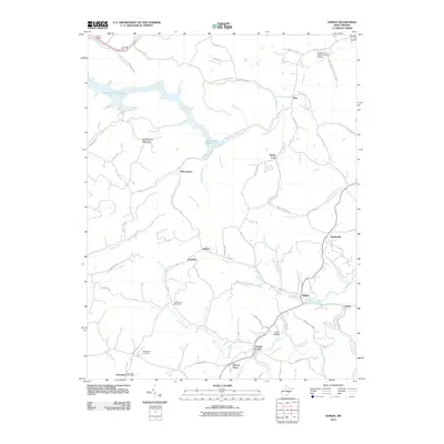
2011 Map of Adrian
USGS Topo · Published 2011About this map
Stonecoal Reservoir dominates the northwestern landscape of this West Virginia survey, its branching fingers reaching into the surrounding hollows near Buckhannon Mountain. The map records a rural network of small settlements and family-named landmarks characteristic of Upshur County, where the economy follows the winding paths of French Creek and Glady Fork. These communities, including Adrian, Frenchton, and the small cluster at McCuetown, are linked by a complex web of local routes like the Sago-Tallmansville road. Genealogists and local historians can locate established burial grounds such as Slab Camp Cemetery and Beechtown Cemetery, which serve the residents of outlying locales like Hoover Town and Grub Hollow. In the northeast, the Buckhannon-Upshur County Airport indicates modern connectivity, contrasting with the traditional post office at Frenchton and the long-standing creek-side hamlets of Gould and Hinkleville.
Find a feature on this map
88 named features on this map. Tap any name to fly to it.
Don’t see what you’re looking for? This feature index may not catch every label — zoom into the map to look around manually.
Map Details
Editions of this 2011 Adrian Map
This is the sole edition of this map. No revisions or reprints were ever made.
Other maps of this area

1893 · Buckhannon
USGS Topo · 1:125,000

1896 · Buckhannon
USGS Topo · 1:125,000

1897 · Buckhannon
USGS Topo · 1:125,000

1904 · Philippi
USGS Topo · 1:62,500

1904 · Weston
USGS Topo · 1:62,500

1912 · Sago
USGS Topo · 1:48,000

1912 · Crawford
USGS Topo · 1:48,000

1914 · Sago
USGS Topo · 1:62,500

1914 · Crawford
USGS Topo · 1:62,500

1925 · Philippi
USGS Topo · 1:62,500