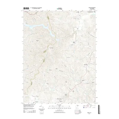
2014 Map of Adrian
USGS Topo · Published 2014About this map
Stonecoal Reservoir dominates the northwestern landscape of this West Virginia survey, its branching fingers reaching into deep drainages like Snyder Run and Beech-Lick Run. The terrain is characterized by a dense network of ridges and hollows, including Buckhannon Mtn and Mulberry Ridge, which dictate the placement of small communities and family-named landmarks. The boundary between Lewis and Upshur Counties meanders across the high ground, crossing several peaks and ridges.
Find a feature on this map
110 named features on this map. Tap any name to fly to it.
Don’t see what you’re looking for? This feature index may not catch every label — zoom into the map to look around manually.
Map Details
Editions of this 2014 Adrian Map
This is the sole edition of this map. No revisions or reprints were ever made.
Other maps of this area

1893 · Buckhannon
USGS Topo · 1:125,000

1896 · Buckhannon
USGS Topo · 1:125,000

1897 · Buckhannon
USGS Topo · 1:125,000

1904 · Philippi
USGS Topo · 1:62,500

1904 · Weston
USGS Topo · 1:62,500

1912 · Sago
USGS Topo · 1:48,000

1912 · Crawford
USGS Topo · 1:48,000

1914 · Sago
USGS Topo · 1:62,500

1914 · Crawford
USGS Topo · 1:62,500

1925 · Philippi
USGS Topo · 1:62,500