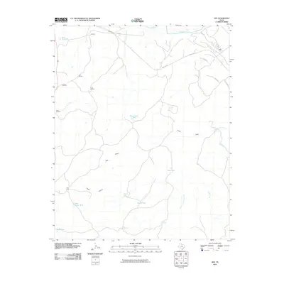
2010 Map of Ady
USGS Topo · Published 2010About this map
The Canadian River meanders across the northern reaches of this Potter County landscape, where ranching operations and water management define the settlement pattern. At the heart of the region, the LS Ranch and the small settlement of Ady anchor a territory crisscrossed by deep drainages and named canyon systems. The map reveals the critical infrastructure of West Texas land use, noting numerous named water sources such as Rheumatism Tank, Lost Tubs Springs, and Eagle Canyon Tank.
Find a feature on this map
33 named features on this map. Tap any name to fly to it.
Don’t see what you’re looking for? This feature index may not catch every label — zoom into the map to look around manually.
Map Details
Editions of this 2010 Ady Map
This is the sole edition of this map. No revisions or reprints were ever made.
Other maps of this area

1934 · Ady
USGS Topo · 1:62,500

1936 · Ady
USGS Topo · 1:62,500

1954 · Tucumcari
USGS Topo · 1:250,000

1958 · Tucumcari
USGS Topo · 1:250,000
1966 · Boden
USGS Topo · 1:24,000

1966 · Jay Taylor Ranch
USGS Topo · 1:24,000

1966 · Halfway Creek
USGS Topo · 1:24,000

1966 · Ady
USGS Topo · 1:24,000
1966 · Wolf Mountain
USGS Topo · 1:24,000

1966 · Rotten Hill
USGS Topo · 1:24,000