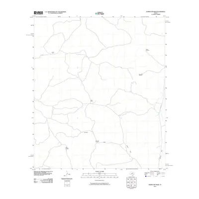
2010 Map of Aermotor Draw
USGS Topo · Published 2010About this map
Aermotor sits within a landscape defined by the intermittent drainage of Aermotor Draw, Cooper Draw, and Johnson Draw in this West Texas quadrangle. The 2010 survey illustrates the fundamental importance of water in this arid ranching environment, documented through a network of named water sources including Aermotor Windmill, Little Kincaid Windmill, Maus Hog Windmill, and White Windmill. These features, alongside Harvik Ranch and West Ranch, highlight a pastoral economy that relies on precisely located infrastructure across the high ground and drainages. The road network consists primarily of county and ranch roads, such as Co RD 402 and Ranch RD 1973, which connect the isolated homesteads and windmills that serve as the primary landmarks of the territory.
Find a feature on this map
13 named features on this map. Tap any name to fly to it.
Don’t see what you’re looking for? This feature index may not catch every label — zoom into the map to look around manually.
Map Details
Editions of this 2010 Aermotor Draw Map
This is the sole edition of this map. No revisions or reprints were ever made.
Other maps of this area

1954 · Sonora
USGS Topo · 1:250,000

1958 · Sonora
USGS Topo · 1:250,000

1970 · Howards Well NE
USGS Topo · 1:24,000

1970 · Aermotor Draw
USGS Topo · 1:24,000

1970 · Steel Star Draw
USGS Topo · 1:24,000

1970 · Indian Draw
USGS Topo · 1:24,000

1970 · Bee Canyon
USGS Topo · 1:24,000

1970 · Howards Well
USGS Topo · 1:24,000

1970 · Howards Well SW
USGS Topo · 1:24,000
1970 · Harrell Canyon
USGS Topo · 1:24,000