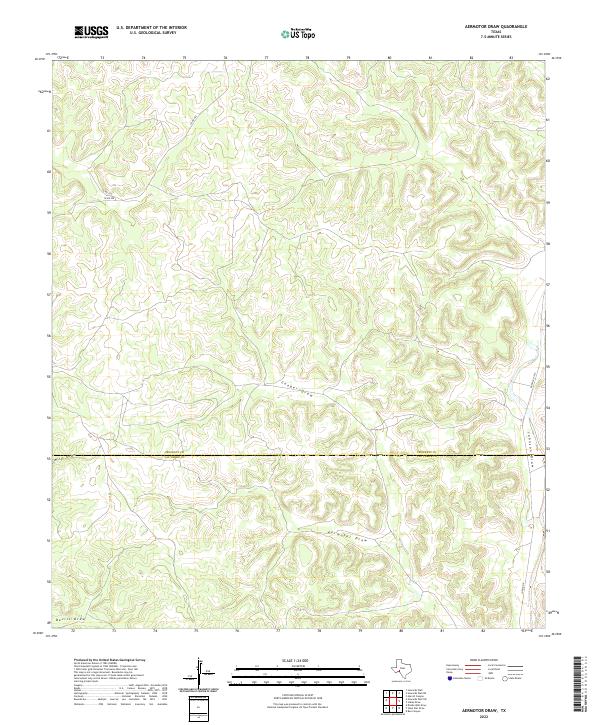
2022 Map of Aermotor Draw
USGS Topo · Published 2022About this map
The high Edwards Plateau landscape of West Texas is defined here by a series of ephemeral drainage systems, most notably Aermotor Draw and Cooper Draw. This 2022 survey captures the arid terrain of the Trans-Pecos region, where the boundary between Crockett County and Val Verde County cuts east-to-west across the central plains. The map illustrates a sparse network of ranching infrastructure, with Ranch Rd 1973 and Jung Rd E providing access to this remote interior. Smaller features like Mills Draw, Devils Draw, and Johnson Draw provide essential landmarks for land management and navigation in a region where surface water is scarce. Local county routes including Co Rd 402 and Co Rd 107 weave through the contours, tracing the high ground between the various draws.
Find a feature on this map
10 named features on this map. Tap any name to fly to it.
Don’t see what you’re looking for? This feature index may not catch every label — zoom into the map to look around manually.
Map Details
Editions of this 2022 Aermotor Draw Map
This is the sole edition of this map. No revisions or reprints were ever made.
Other maps of this area

1954 · Sonora
USGS Topo · 1:250,000

1958 · Sonora
USGS Topo · 1:250,000

1970 · Howards Well NE
USGS Topo · 1:24,000

1970 · Aermotor Draw
USGS Topo · 1:24,000

1970 · Steel Star Draw
USGS Topo · 1:24,000

1970 · Indian Draw
USGS Topo · 1:24,000

1970 · Bee Canyon
USGS Topo · 1:24,000

1970 · Howards Well
USGS Topo · 1:24,000

1970 · Howards Well SW
USGS Topo · 1:24,000
1970 · Harrell Canyon
USGS Topo · 1:24,000