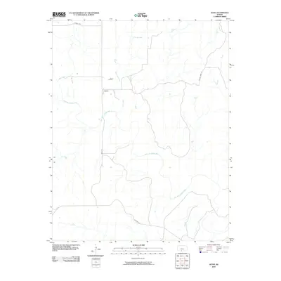
2009 Map of Aetna
USGS Topo · Published 2009About this map
Aetna serves as the quiet center of this Barber County landscape, where the prairie is defined by the winding course of the Salt Fork Arkansas River. The settlement's history is anchored by the Aetna Cemetery, situated just north of the town site along the divide between drainage basins. A complex network of watercourses, including Mule Creek, Cave Creek, and the various branches of Dry Creek, reveals the erosive power of water on the Kansas plains. Rural travel is facilitated by established routes like Aetna Rd and Hackberry Rd, while more remote landmarks such as Painted Post suggest older navigational markers or property bounds. The map provides a clear look at the sparse rural infrastructure and the relationship between early roadways and the natural hydrology of the region in the early 21st century.
Find a feature on this map
12 named features on this map. Tap any name to fly to it.
Don’t see what you’re looking for? This feature index may not catch every label — zoom into the map to look around manually.
Map Details
Editions of this 2009 Aetna Map
This is the sole edition of this map. No revisions or reprints were ever made.
Other maps of this area

1891 · Medicine Lodge
USGS Topo · 1:125,000

1892 · Coldwater
USGS Topo · 1:125,000

1893 · Medicine Lodge
USGS Topo · 1:125,000

1955 · Woodward
USGS Topo · 1:250,000

1955 · Pratt
USGS Topo · 1:250,000

1958 · Woodward
USGS Topo · 1:250,000

1959 · Pratt
USGS Topo · 1:250,000

1969 · Tegarden NE
USGS Topo · 1:24,000

1969 · Tegarden NW
USGS Topo · 1:24,000

1970 · Freedom NE
USGS Topo · 1:24,000