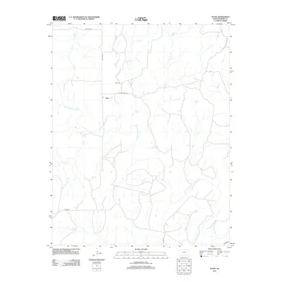
2012 Map of Aetna
USGS Topo · Published 2012About this map
The Salt Fork Arkansas River carves a winding path through this corner of Barber County, defining a landscape shaped by intermittent watercourses like Mule Cr and W Dry Cr. In the early 21st century, the small community of Aetna remains a primary point of reference, centered near the intersection of SW Aetna Rd and Cottage Creek Rd. Genealogists and local historians will find the Aetna Cem situated north of the settlement, a vital record of the families who established themselves in this prairie region. The surrounding terrain is marked by named locales such as Painted Post to the north and Hackberry to the south, connected by a network of rural routes including N2300 Rd. This survey documents the persistent ranching and agricultural character of the southern Kansas plains, where life follows the drainage patterns of Cave Cr and the larger river system.
Find a feature on this map
13 named features on this map. Tap any name to fly to it.
Don’t see what you’re looking for? This feature index may not catch every label — zoom into the map to look around manually.
Map Details
Editions of this 2012 Aetna Map
This is the sole edition of this map. No revisions or reprints were ever made.
Other maps of this area

1891 · Medicine Lodge
USGS Topo · 1:125,000

1892 · Coldwater
USGS Topo · 1:125,000

1893 · Medicine Lodge
USGS Topo · 1:125,000

1955 · Woodward
USGS Topo · 1:250,000

1955 · Pratt
USGS Topo · 1:250,000

1958 · Woodward
USGS Topo · 1:250,000

1959 · Pratt
USGS Topo · 1:250,000

1969 · Tegarden NE
USGS Topo · 1:24,000

1969 · Tegarden NW
USGS Topo · 1:24,000

1970 · Freedom NE
USGS Topo · 1:24,000