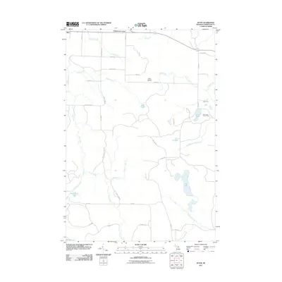
2011 Map of Afton
USGS Topo · Published 2011About this map
The Pigeon River system defines this Cheboygan County landscape, winding northward through a network of creeks and small glacial lakes. Near the northern boundary, the settlement of Afton sits alongside Kimberly Creek, while Fingerboard Corner marks a rural intersection to the east. The terrain is characterized by its numerous water bodies, including Lake Sixteen, Lost Lake, and the expansive Dog Lake to the southeast.
Find a feature on this map
43 named features on this map. Tap any name to fly to it.
Don’t see what you’re looking for? This feature index may not catch every label — zoom into the map to look around manually.
Map Details
Editions of this 2011 Afton Map
This is the sole edition of this map. No revisions or reprints were ever made.
Other maps of this area

1954 · Gaylord
USGS Topo · 1:62,500

1954 · Hetherton
USGS Topo · 1:62,500

1955 · Cheboygan
USGS Topo · 1:250,000

1957 · Tower
USGS Topo · 1:62,500

1957 · Wolverine
USGS Topo · 1:62,500

1958 · Cheboygan
USGS Topo · 1:250,000

1982 · Petoskey
USGS Topo · 1:100,000

1986 · Silver Lake
USGS Topo · 1:24,000
1986 · Legrand
USGS Topo · 1:24,000
1986 · Tower
USGS Topo · 1:24,000