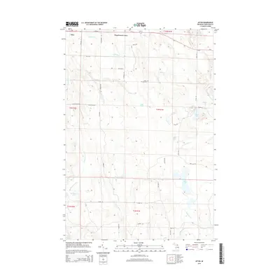
2014 Map of Afton
USGS Topo · Published 2014About this map
Afton and the nearby Fingerboard Corner serve as the primary landmarks in this 2014 survey of north-central Michigan. The landscape is defined by its complex hydrography, dominated by the Pigeon River and its tributary, the Little Pigeon River, which wind through the terrain alongside numerous named water bodies including Dog Lake, Lake Sixteen, and MacAndrews Lake. These waterways are fed by smaller streams such as Kimberly Cr and McMasters Cr, reflecting a region deeply tied to its natural drainage patterns.
Find a feature on this map
48 named features on this map. Tap any name to fly to it.
Don’t see what you’re looking for? This feature index may not catch every label — zoom into the map to look around manually.
Map Details
Editions of this 2014 Afton Map
This is the sole edition of this map. No revisions or reprints were ever made.
Other maps of this area

1954 · Gaylord
USGS Topo · 1:62,500

1954 · Hetherton
USGS Topo · 1:62,500

1955 · Cheboygan
USGS Topo · 1:250,000

1957 · Tower
USGS Topo · 1:62,500

1957 · Wolverine
USGS Topo · 1:62,500

1958 · Cheboygan
USGS Topo · 1:250,000

1982 · Petoskey
USGS Topo · 1:100,000

1986 · Silver Lake
USGS Topo · 1:24,000
1986 · Legrand
USGS Topo · 1:24,000
1986 · Tower
USGS Topo · 1:24,000