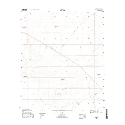
2017 Map of Afton
USGS Topo · Published 2017About this map
Afton and the rail-aligned community of Rutter anchor this 2017 survey of the desert landscape in Doña Ana County. The terrain is defined by a sparse but vital network of county roads, including Co Rd B004 and Co Rd B007, which traverse the open basin between low-relief volcanic features and ancient drainage patterns. The map detail reflects a modern era of land management, where traditional township and range lines like t25s r1w intersect with contemporary infrastructure. For those researching the geography of the Mesilla Valley periphery, the map provides precise locations for remote desert crossings and the distinct corridor formed by the railroad as it passes through this arid stretch of New Mexico.
Find a feature on this map
18 named features on this map. Tap any name to fly to it.
Don’t see what you’re looking for? This feature index may not catch every label — zoom into the map to look around manually.
Map Details
Editions of this 2017 Afton Map
This is the sole edition of this map. No revisions or reprints were ever made.
Other maps of this area

1891 · Las Cruces
USGS Topo · 1:125,000

1893 · Las Cruces
USGS Topo · 1:125,000

1917 · Noria
USGS Topo · 1:62,500

1917 · Mt. Riley
USGS Topo · 1:62,500

1918 · Mt. Riley
USGS Topo · 1:62,500

1918 · Noria
USGS Topo · 1:62,500

1929 · Mt. Riley
USGS Topo · 1:62,500

1941 · Aden
USGS Topo · 1:62,500

1943 · Aden
USGS Topo · 1:62,500

1943 · Afton
USGS Topo · 1:62,500