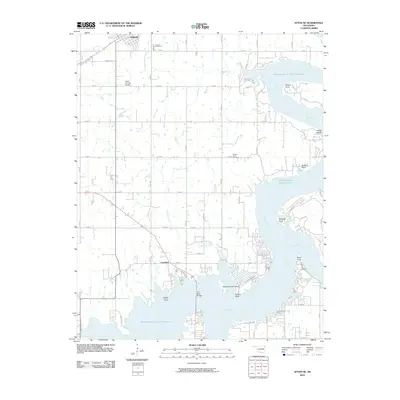
2010 Map of Afton NE
USGS Topo · Published 2010About this map
The town of Fairland serves as the northern anchor for this Oklahoma landscape, situated just north of the extensive waters of Grand Lake O' The Cherokees. This 2010 survey illustrates the developed shoreline of the Neosho River and Elk River arms, where numerous residential points and inlets such as Paradise Point, Reed Point, and Catfish Point define the recreational and residential character of the region. The map captures the transition from the organized street grid of Fairland and its surrounding agricultural sections to the more irregular, winding roads that serve the lakefront communities near Copeland and Sulphur Bend.
Find a feature on this map
44 named features on this map. Tap any name to fly to it.
Don’t see what you’re looking for? This feature index may not catch every label — zoom into the map to look around manually.
Map Details
Editions of this 2010 Afton NE Map
This is the sole edition of this map. No revisions or reprints were ever made.
Other maps of this area

1907 · Wyandotte
USGS Topo · 1:125,000

1909 · Wyandotte
USGS Topo · 1:125,000

1954 · Tulsa
USGS Topo · 1:250,000

1958 · Tulsa
USGS Topo · 1:250,000

1961 · Miami SE
USGS Topo · 1:24,000

1961 · Wyandotte
USGS Topo · 1:24,000

1961 · Miami SW
USGS Topo · 1:24,000

1963 · Tulsa
USGS Topo · 1:250,000
1964 · Cayuga
USGS Topo · 1:24,000

1964 · Dodge
USGS Topo · 1:24,000