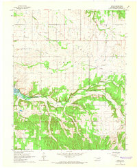
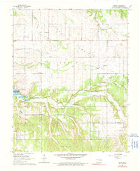
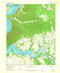
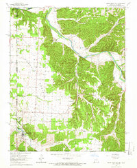
1964 Map of Dodge
USGS Topo · Published 1966About this map
Cow Skin Prairie dominates the northern landscape of this Oklahoma survey, where the rolling plains meet the inlet arms of Lake O' the Cherokees. The map centers on the small settlement of Dodge, a community defined by its proximity to an Old Railroad Grade and a network of country churches like Dodge Ch and Peters Prairie Ch. The landscape is notably dotted with small family and community burial grounds, including Olympus Cem, Pollan Cem, and Sloan Cem, reflecting the deep-rooted rural settlement patterns of Delaware County in the mid-1960s.
Find a feature on this map
30 named features on this map. Tap any name to fly to it.
Don’t see what you’re looking for? This feature index may not catch every label — zoom into the map to look around manually.
Map Details
Editions of this 1964 Dodge Map
2 editions found
Other maps of this area

1899 · Siloam Springs
USGS Topo · 1:125,000

1903 · Siloam Springs
USGS Topo · 1:125,000

1904 · Siloam Springs
USGS Topo · 1:125,000

1907 · Wyandotte
USGS Topo · 1:125,000

1909 · Wyandotte
USGS Topo · 1:125,000

1954 · Tulsa
USGS Topo · 1:250,000

1958 · Tulsa
USGS Topo · 1:250,000

1963 · Tulsa
USGS Topo · 1:250,000
1964 · Cayuga
USGS Topo · 1:24,000
1965 · South West City
USGS Topo · 1:24,000