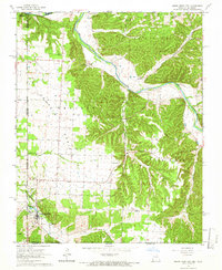
1965 Map of South West City
USGS Topo · Published 1966About this map
South West City sits at the nexus of the Missouri, Oklahoma, and Arkansas borders, serving as a focal point for this 1960s topographic study. The landscape is defined by the winding course of the Elk River and the broad expanse of Wskin Prairie, which dominates the western half of the quadrangle. An Indian Reservation Boundary runs along the western edge, marking the transition into Oklahoma and Delaware County.
Find a feature on this map
33 named features on this map. Tap any name to fly to it.
Don’t see what you’re looking for? This feature index may not catch every label — zoom into the map to look around manually.
Map Details
Editions of this 1965 South West City Map
This is the sole edition of this map. No revisions or reprints were ever made.
Other maps of this area

1899 · Fayetteville
USGS Topo · 1:125,000

1899 · Siloam Springs
USGS Topo · 1:125,000

1901 · Fayetteville
USGS Topo · 1:125,000

1903 · Siloam Springs
USGS Topo · 1:125,000

1904 · Siloam Springs
USGS Topo · 1:125,000

1904 · Fayetteville
USGS Topo · 1:125,000

1907 · Wyandotte
USGS Topo · 1:125,000

1909 · Wyandotte
USGS Topo · 1:125,000

1940 · Noel
USGS Topo · 1:62,500

1943 · Noel
USGS Topo · 1:62,500