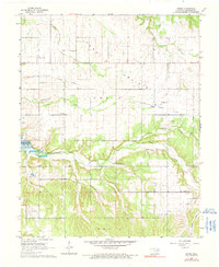
1964 Map of Dodge
USGS Topo · Published 1990About this map
Cow Skin Prairie stretches across this portion of Delaware County, where the transition from open grasslands to the wooded drainage of Honey Creek defines the local topography. The map documents a landscape heavily marked by early settlement history, featuring numerous family and community burial grounds such as Olympus Cem, Sloan Cem, and Scraper Cem. The community of Dodge serves as a focal point, situated near the Old Dodge Railroad Grade, a reminder of the former rail infrastructure that once serviced this corner of Oklahoma. To the west, the shoreline of Lake O' the Cherokees appears, while the presence of the Grove Municipal Airport and a nearby Fish Hatchery reflects the mid-century development of the region's utilities and resources.
Find a feature on this map
33 named features on this map. Tap any name to fly to it.
Don’t see what you’re looking for? This feature index may not catch every label — zoom into the map to look around manually.
Map Details
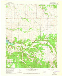
Editions of this 1964 Dodge Map
2 editions found
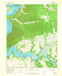
Other maps of this area

1899 · Siloam Springs
USGS Topo · 1:125,000

1903 · Siloam Springs
USGS Topo · 1:125,000

1904 · Siloam Springs
USGS Topo · 1:125,000

1907 · Wyandotte
USGS Topo · 1:125,000

1909 · Wyandotte
USGS Topo · 1:125,000

1954 · Tulsa
USGS Topo · 1:250,000

1958 · Tulsa
USGS Topo · 1:250,000

1963 · Tulsa
USGS Topo · 1:250,000
1964 · Cayuga
USGS Topo · 1:24,000
1964 · Dodge
USGS Topo · 1:24,000