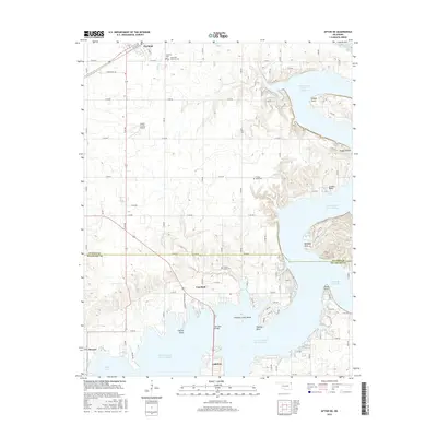
2016 Map of Afton NE
USGS Topo · Published 2016About this map
Grand Lake O' the Cherokees dominates this corner of Oklahoma, where the waters reach into the valleys of Ogeechee Cr and Hickory Cr. The settlement of Fairland occupies the northern section, defined by the intersection of S Main St and Railway Ave. The landscape transitions from the agricultural plains in the west to a highly indented shoreline featuring distinctive points and hollows like Wilson Point and Osage Hollow.
Find a feature on this map
74 named features on this map. Tap any name to fly to it.
Don’t see what you’re looking for? This feature index may not catch every label — zoom into the map to look around manually.
Map Details
Editions of this 2016 Afton NE Map
This is the sole edition of this map. No revisions or reprints were ever made.
Other maps of this area

1907 · Wyandotte
USGS Topo · 1:125,000

1909 · Wyandotte
USGS Topo · 1:125,000

1954 · Tulsa
USGS Topo · 1:250,000

1958 · Tulsa
USGS Topo · 1:250,000

1961 · Miami SE
USGS Topo · 1:24,000

1961 · Wyandotte
USGS Topo · 1:24,000

1961 · Miami SW
USGS Topo · 1:24,000

1963 · Tulsa
USGS Topo · 1:250,000
1964 · Cayuga
USGS Topo · 1:24,000

1964 · Dodge
USGS Topo · 1:24,000