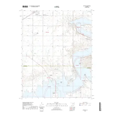
2018 Map of Afton NE
USGS Topo · Published 2018About this map
Grand Lake O' the Cherokees and the northern reaches of Grove define this landscape along the border of Ottawa and Delaware counties. This modern topographic study shows a developed lakeside environment characterized by numerous residential access roads and established community hubs. In the north, Fairland is situated along the BNSF Railway, while the southern portion of the map is dominated by the complex shoreline and inlets of the lake, including Echo Bay and Catfish Point. The transition from the agriculture-heavy northern plains to the recreational and residential lakefront is bridged by Sail Boat Bridge. For those researching local family history, several burial grounds are documented, including Hickory Grove Cem, Sulphur Bend Cem, and Fairland Cem. The area also features the Green Country Airpark, serving the local aviation community near the winding Ogeechee Cr.
Find a feature on this map
51 named features on this map. Tap any name to fly to it.
Don’t see what you’re looking for? This feature index may not catch every label — zoom into the map to look around manually.
Map Details
Editions of this 2018 Afton NE Map
This is the sole edition of this map. No revisions or reprints were ever made.
Other maps of this area

1907 · Wyandotte
USGS Topo · 1:125,000

1909 · Wyandotte
USGS Topo · 1:125,000

1954 · Tulsa
USGS Topo · 1:250,000

1958 · Tulsa
USGS Topo · 1:250,000

1961 · Miami SE
USGS Topo · 1:24,000

1961 · Wyandotte
USGS Topo · 1:24,000

1961 · Miami SW
USGS Topo · 1:24,000

1963 · Tulsa
USGS Topo · 1:250,000
1964 · Cayuga
USGS Topo · 1:24,000

1964 · Dodge
USGS Topo · 1:24,000