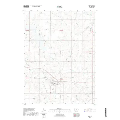
2018 Map of Afton
USGS Topo · Published 2018About this map
Afton serves as the central hub of this Union County landscape, where the town grid is bounded by a network of waterways and early cemeteries. The local geography is defined by the winding course of Threemile Creek and the nearby Lake Afton, creating a terrain of subtle ridges and valleys. Genealogists will find several burial sites preserved on the land, including Green Lawn Cem, Calvary Cem, and the more secluded Norris Family Cem to the south.
Find a feature on this map
68 named features on this map. Tap any name to fly to it.
Don’t see what you’re looking for? This feature index may not catch every label — zoom into the map to look around manually.
Map Details
Editions of this 2018 Afton Map
This is the sole edition of this map. No revisions or reprints were ever made.
Other maps of this area

1951 · Afton
USGS Topo · 1:62,500

1954 · Omaha
USGS Topo · 1:250,000

1955 · Nebraska City
USGS Topo · 1:250,000

1957 · Nebraska City
USGS Topo · 1:250,000

1957 · Omaha
USGS Topo · 1:250,000

1958 · Omaha
USGS Topo · 1:250,000

1958 · Nebraska City
USGS Topo · 1:250,000

1980 · Creston East
USGS Topo · 1:24,000

1981 · Zion
USGS Topo · 1:24,000
1981 · Arispe
USGS Topo · 1:24,000