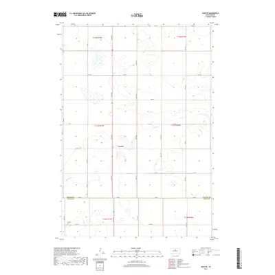
2017 Map of Agar NE
USGS Topo · Published 2017About this map
Gorman sits along the meandering path of Artichoke Cr in this high-plains landscape, where the section-line roads of Potter County meet the northern edge of Sully County. The area is characterized by the systematic grid of the Public Land Survey System, with townships like t117n r77w and t117n r76w defining the rural organization. Small wetlands and depressions dot the prairie between arterial routes such as 304th Ave and County Road 750. To the southwest, near the intersection of 302nd Ave and 173rd St, the Schreiber Cemetery remains a significant local landmark for genealogists. This 2017 survey by the U.S. Geological Survey provides a precise view of the drainage patterns of Artichoke Creek as it winds through this agricultural region.
Find a feature on this map
31 named features on this map. Tap any name to fly to it.
Don’t see what you’re looking for? This feature index may not catch every label — zoom into the map to look around manually.
Map Details
Editions of this 2017 Agar NE Map
This is the sole edition of this map. No revisions or reprints were ever made.
Other maps of this area

1953 · Huron
USGS Topo · 1:250,000

1953 · McIntosh
USGS Topo · 1:250,000

1954 · Aberdeen
USGS Topo · 1:250,000

1954 · Pierre
USGS Topo · 1:250,000

1954 · Huron
USGS Topo · 1:250,000

1956 · Aberdeen
USGS Topo · 1:250,000

1958 · Pierre
USGS Topo · 1:250,000

1958 · McIntosh
USGS Topo · 1:250,000

1965 · Agar SW
USGS Topo · 1:24,000

1965 · Agar
USGS Topo · 1:24,000