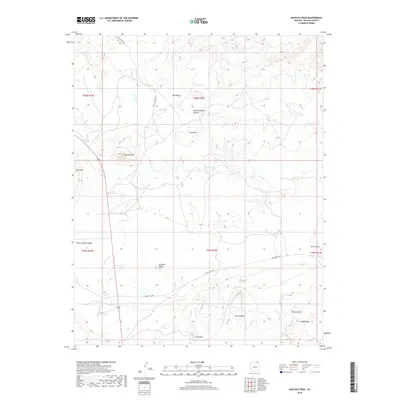
2018 Map of Agathla Peak
USGS Topo · Published 2018About this map
Agathla Peak and the surrounding high desert of Navajo County define this 2018 survey, which documents the prominent volcanic plugs and geological formations south of the Utah border. The landscape is marked by striking vertical features such as Owl Rock and Chaistla Butte, while the Porras Dikes showcase the region's distinct igneous intrusions. Traditional travel routes like Old El Capitan Rd and Indian Rte 6460 provide the primary access through the Little Capitan Valley.
Find a feature on this map
22 named features on this map. Tap any name to fly to it.
Don’t see what you’re looking for? This feature index may not catch every label — zoom into the map to look around manually.
Map Details
Editions of this 2018 Agathla Peak Map
This is the sole edition of this map. No revisions or reprints were ever made.
Other maps of this area

1883 · Marsh Pass
USGS Topo · 1:250,000

1892 · Marsh Pass
USGS Topo · 1:250,000

1952 · Agathla Peak 1 NW
USGS Topo · 1:24,000

1952 · Boot Mesa
USGS Topo · 1:62,500

1952 · Agathla Peak 1 NE
USGS Topo · 1:24,000

1952 · Agathla Peak 2 SE
USGS Topo · 1:24,000

1952 · Agathla Peak 1 SE
USGS Topo · 1:24,000

1952 · Agathla Peak 2 NE
USGS Topo · 1:24,000

1952 · Agathla Peak
USGS Topo · 1:62,500

1952 · Agathla Peak 1 SW
USGS Topo · 1:24,000