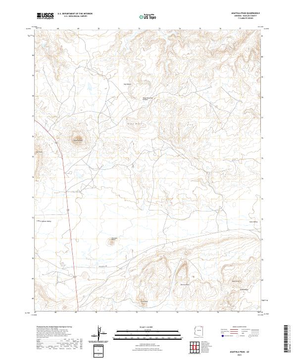
2021 Map of Agathla Peak
USGS Topo · Published 2021About this map
Agathla Peak dominates this corner of the Navajo Nation, standing as a prominent volcanic neck that rises sharply above the surrounding high desert. The landscape is defined by dramatic erosion, featuring the deep incision of Tseya Neechee Canyon and the broad expanses of Segi Mesas and the Gray Hills. Navigated primarily by Indian Rte 6460, the region showcases a remarkable concentration of geological landmarks, from the sharp spires of Chaistla Butte and Owl Rock to the linear formations of Porras Dikes. This 2021 survey documents the terrain as it descends into Little Capitan Valley and Cane Valley, bordered by the long, sloping face of Comb Ridge. Notable natural features such as a Natural Arch and Lion Rock provide specific points of interest within this sparsely populated and culturally significant landscape.
Find a feature on this map
19 named features on this map. Tap any name to fly to it.
Don’t see what you’re looking for? This feature index may not catch every label — zoom into the map to look around manually.
Map Details
Editions of this 2021 Agathla Peak Map
This is the sole edition of this map. No revisions or reprints were ever made.
Other maps of this area

1883 · Marsh Pass
USGS Topo · 1:250,000

1892 · Marsh Pass
USGS Topo · 1:250,000

1952 · Agathla Peak 1 NW
USGS Topo · 1:24,000

1952 · Boot Mesa
USGS Topo · 1:62,500

1952 · Agathla Peak 1 NE
USGS Topo · 1:24,000

1952 · Agathla Peak 2 SE
USGS Topo · 1:24,000

1952 · Agathla Peak 1 SE
USGS Topo · 1:24,000

1952 · Agathla Peak 2 NE
USGS Topo · 1:24,000

1952 · Agathla Peak
USGS Topo · 1:62,500

1952 · Agathla Peak 1 SW
USGS Topo · 1:24,000