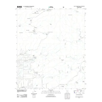
2011 Map of Agua Caliente Hill
USGS Topo · Published 2011About this map
Agua Caliente Hill rises over a landscape defined by significant water management and recreation in the Pima County desert. In this 2011 survey, the area shows a distinct pattern of ranching history through the presence of Bellota Ranch, Deep Well Ranch, and the M R Ranch. The northern section is dominated by the Santa Catalina Mountains, featuring landmarks like Thimble Peak and Windy Point. The map provides a look at the historical and recreational footprint of the region, including the Molino Basin Prison Camp Trailhead and Gordon Hirabayashi Campground. Numerous stock tanks and springs, such as Tequila Tank, Jack Daniels Tank, and Agua Caliente Spring, are scattered throughout the drainages of Agua Caliente Wash and Molino Canyon, illustrating the critical role of water sources in this arid environment.
Find a feature on this map
97 named features on this map. Tap any name to fly to it.
Don’t see what you’re looking for? This feature index may not catch every label — zoom into the map to look around manually.
Map Details
Editions of this 2011 Agua Caliente Hill Map
This is the sole edition of this map. No revisions or reprints were ever made.
Other maps of this area

1904 · Tucson
USGS Topo · 1:125,000

1905 · Tucson
USGS Topo · 1:125,000

1948 · Tucson
USGS Topo · 1:62,500

1956 · Tucson
USGS Topo · 1:250,000

1957 · Tucson East
USGS Topo · 1:24,000

1957 · Bellota Ranch
USGS Topo · 1:62,500

1957 · Tucson
USGS Topo · 1:62,500

1957 · Rincon Valley
USGS Topo · 1:62,500

1957 · Sabino Canyon
USGS Topo · 1:24,000
1957 · Mount Lemmon
USGS Topo · 1:62,500