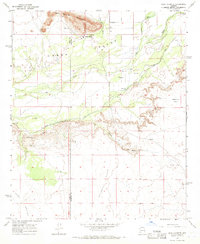
1965 Map of Agua Caliente
USGS Topo · Published 1966About this map
Agua Caliente sits at the foot of the Agua Caliente Mountains, marking a historic desert oasis near the border of Yuma and Maricopa counties. During the mid-1960s, this arid landscape was defined by its water management, centered on the Gila River and the South Gila Ditch. The presence of a small Cem and Corral near the settlement indicates the localized footprint of ranching and habitation in this remote corner of the Hyder Valley.
Find a feature on this map
21 named features on this map. Tap any name to fly to it.
Don’t see what you’re looking for? This feature index may not catch every label — zoom into the map to look around manually.
Map Details
Editions of this 1965 Agua Caliente Map
3 editions found
Other maps of this area

1927 · Hyder
USGS Topo · 1:62,500

1929 · Aztec
USGS Topo · 1:62,500

1930 · Hyder
USGS Topo · 1:62,500

1942 · Vicksburg
USGS Topo · 1:250,000

1949 · Sentinel
USGS Topo · 1:62,500

1950 · Sentinel
USGS Topo · 1:62,500

1950 · Aztec
USGS Topo · 1:62,500

1951 · Dendora Valley
USGS Topo · 1:62,500

1953 · Ajo
USGS Topo · 1:250,000

1954 · Phoenix
USGS Topo · 1:250,000