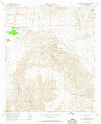
1959 Map of Agua Caliente Springs
USGS Topo · Published 1967About this map
The Old Overland Stage Route traces a historic path of western migration across this 1959 survey of San Diego County, marking the transition from the Tierra Blanca Mountains into the arid expanse of Anza-Borrego Desert State Park. The map preserves a critical snapshot of mid-century desert settlement and recreation, anchored by the Vallecito Stage Station County Park and the nearby Agua Caliente County Park. These sites, along with isolated landmarks like the Crawford Ranch, highlight the importance of water sources in this landscape, where names like Burro Spring and Agua Caliente Springs indicate vital oases.
Find a feature on this map
41 named features on this map. Tap any name to fly to it.
Don’t see what you’re looking for? This feature index may not catch every label — zoom into the map to look around manually.
Map Details
Editions of this 1959 Agua Caliente Springs Map
3 editions found
Other maps of this area

1931 · Vallecito
USGS Topo · 1:125,000

1931 · Carrizo
USGS Topo · 1:125,000

1939 · Borrego
USGS Topo · 1:62,500

1942 · Barrel Spring
USGS Topo · 1:62,500

1942 · Borego
USGS Topo · 1:62,500

1942 · Carrizo Mtn
USGS Topo · 1:62,500

1942 · Cuyapaipe
USGS Topo · 1:62,500

1943 · Vallecito
USGS Topo · 1:125,000

1947 · Santa Ana
USGS Topo · 1:250,000
1947 · Barrel Spring
USGS Topo · 1:62,500