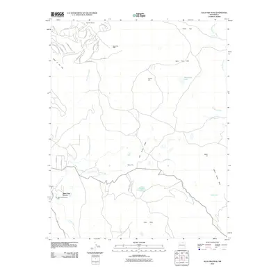
2010 Map of Agua Fria Peak
USGS Topo · Published 2010About this map
Angel Fire Ski Area and the high-elevation resort developments of Colfax County dominate this mountain landscape. The survey captures the complex road networks branching off El Camino Real, including residential clusters like Black Lake Resorts and a variety of imaginative street names such as E Dream Way and Happy Way. This era of modern recreation is defined by the proximity of the ski slopes to the drainage basins of Cieneguilla Creek and the headwaters of Coyote Creek.
Find a feature on this map
44 named features on this map. Tap any name to fly to it.
Don’t see what you’re looking for? This feature index may not catch every label — zoom into the map to look around manually.
Map Details
Editions of this 2010 Agua Fria Peak Map
This is the sole edition of this map. No revisions or reprints were ever made.
Other maps of this area

1954 · Raton
USGS Topo · 1:250,000

1956 · Tooth Of Time
USGS Topo · 1:62,500

1958 · Raton
USGS Topo · 1:250,000

1965 · Osha Mountain
USGS Topo · 1:24,000

1965 · Chacon
USGS Topo · 1:24,000

1965 · Palo Flechado Pass
USGS Topo · 1:24,000

1966 · Guadalupita
USGS Topo · 1:24,000

1966 · Ocate
USGS Topo · 1:24,000

1983 · Taos
USGS Topo · 1:100,000
1987 · Agua Fria Peak
USGS Topo · 1:24,000