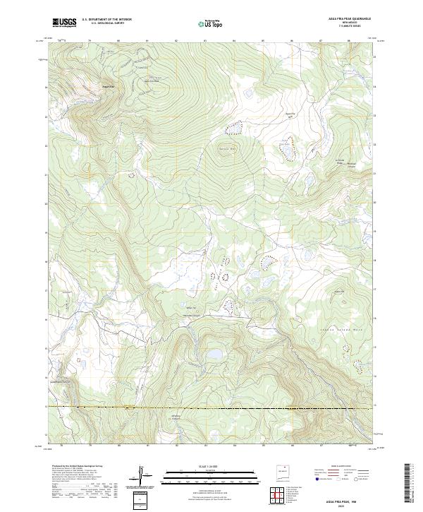
2023 Map of Agua Fria Peak
USGS Topo · Published 2023About this map
Angel Fire anchors the northwestern corner of this high-altitude landscape, where residential development branches out into the foothills via El Camino Real and Mountain Park Way. The terrain is defined by the significant rise of Agua Fria Peak, which gives way to the broad Agua Fria Park and the distinct volcanic-like profile of Laguna Salada Mesa to the southeast. Water drainage patterns are central to the geography, with Cieneguilla Creek flowing through the settlement area and Coyote Creek carving through the southern canyons near the border of Colfax County and Mora County. The map reveals a transition from organized resort-style street networks in the north to isolated landmarks like Willys Tip and Spruce Hill, illustrating the interplay between mountain habitation and the wilder, drainage-cut topography of Martinez Canyon and LeFebres Canyon.
Find a feature on this map
52 named features on this map. Tap any name to fly to it.
Don’t see what you’re looking for? This feature index may not catch every label — zoom into the map to look around manually.
Map Details
Editions of this 2023 Agua Fria Peak Map
This is the sole edition of this map. No revisions or reprints were ever made.
Other maps of this area

1954 · Raton
USGS Topo · 1:250,000

1956 · Tooth Of Time
USGS Topo · 1:62,500

1958 · Raton
USGS Topo · 1:250,000

1965 · Osha Mountain
USGS Topo · 1:24,000

1965 · Chacon
USGS Topo · 1:24,000

1965 · Palo Flechado Pass
USGS Topo · 1:24,000

1966 · Guadalupita
USGS Topo · 1:24,000

1966 · Ocate
USGS Topo · 1:24,000

1983 · Taos
USGS Topo · 1:100,000
1987 · Agua Fria Peak
USGS Topo · 1:24,000