1950 Map of Aguadilla SO
USGS Topo · Published 1950About this map
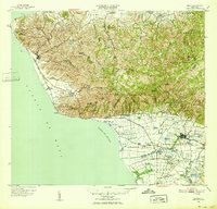
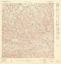
Aguada sits along the northwestern coast of Puerto Rico in this mid-century preliminary topography, illustrating the intersection of maritime geography and colonial-era rail infrastructure. The American Railroad of Porto Rico tracks run parallel to the coastline, connecting the coastal barrios of Carrizal and Guaniquilla with the inland sugar economy. The map records several significant water features including the Río Ingenio, Río Culebra, and the Río Grande, which define the low-lying coastal plains before they reach the Océano Atlántico. Notable landmarks such as the Aguada Parada de Colón reflect local historical narratives of exploration, while the presence of the Desvío Guayabo suggest the localized transport and agricultural bypasses of the period. This survey detail, compiled from fieldwork spanning the 1920s to the late 1940s, provides an intricate look at the land divisions between the Municipio de Aguada and Municipio de Rincón.
Find a feature on this map
25 named features on this map. Tap any name to fly to it.
Don’t see what you’re looking for? This feature index may not catch every label — zoom into the map to look around manually.
Map Details
Editions of this 1950 Aguadilla SO Map
This is the sole edition of this map. No revisions or reprints were ever made.
Other maps of this area

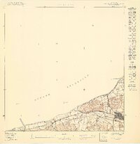
1937 · Aguadilla
USGS Topo · 1:20,000

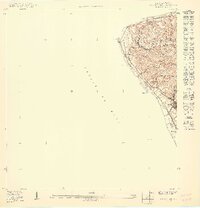
1941 · Rincon
USGS Topo · 1:30,000

1941 · Rincon
USGS Topo · 1:30,000

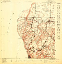
1942 · Aguadilla
USGS Topo · 1:30,000

1947 · Rincon
USGS Topo · 1:30,000

1947 · Rincon
USGS Topo · 1:30,000
1949 · Rincon
USGS Topo · 1:30,000
1950 · Rincon ONO
USGS Topo · 1:10,000
1950 · Aguadilla NE
USGS Topo · 1:10,000
1950 · Rincon NE
USGS Topo · 1:10,000
Featured Places
- Aguada, Aguada
- Sector Casualidad, Aguada
- Noboa Vieja, Aguada
- Residencial Francisco Egipciaco, Aguada
- Carrizal, Aguada