1950 Map of Rincon ONO
USGS Topo · Published 1950About this map
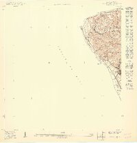
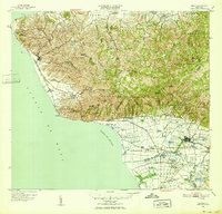
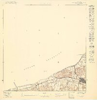
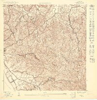
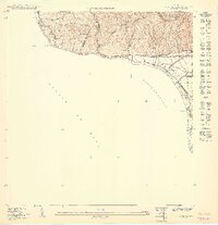
The American RR of Porto Rico traces the northwestern coastline of the island near the mid-century, following the dramatic curve of the shoreline from Pta Gorda toward the town of Rincón. This coastal topography is defined by the steep elevation of Cerro Martinica and the Puntas region, where small clusters of buildings at Centro Puntas indicate rural settlement patterns before significant modern expansion. The map details a landscape where traditional transit routes like the Camino Carretas wind through the hills, connecting agricultural areas to the coast. Near the southern edge of the quadrangle, the settlement of Pueblo sits inland from the bay at Ensenada, supported by local water sources such as Quebrada Piletas and Quebrada Los Ramos, which drain westward into the Pasaje de Mona.
Find a feature on this map
16 named features on this map. Tap any name to fly to it.
Don’t see what you’re looking for? This feature index may not catch every label — zoom into the map to look around manually.
Map Details
Editions of this 1950 Rincon ONO Map
This is the sole edition of this map. No revisions or reprints were ever made.
Other maps of this area

1937 · Aguadilla
USGS Topo · 1:20,000

1941 · Rincon
USGS Topo · 1:30,000

1941 · Rincon
USGS Topo · 1:30,000

1942 · Aguadilla
USGS Topo · 1:30,000

1947 · Rincon
USGS Topo · 1:30,000

1947 · Rincon
USGS Topo · 1:30,000
1949 · Rincon
USGS Topo · 1:30,000
1950 · Aguadilla SO
USGS Topo · 1:10,000
1950 · Rincon NO
USGS Topo · 1:10,000
1950 · Rincon SO
USGS Topo · 1:10,000