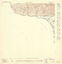
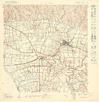
1950 Map of Rincon SO
USGS Topo · Published 1950About this map
Coastal sugar production and railway transport define this western corner of Puerto Rico, where the hills of Barrero and Cadena meet the sea. The American RR Porto Rico skirts the shoreline of the Bahía de Añasco, serving local settlements and industrial sites like Hacienda Eugenia. Small rail sidings and neighborhoods such as Desvío Arenas and Desvío Eugenia indicate the vital role of the sugar industry and transport in the region's economy during the mid-century. Numerous streams, including Quebrada Caguabo and Quebrada Sebastián, drain from the steep ridges of Cerro Vigía and Atalaya toward the Pasaje de Mona. This survey reflects the landscape just as the agricultural and transit patterns of the early twentieth century were still deeply etched into the topography of the Municipio de Añasco and Municipio de Rincón.
Find a feature on this map
28 named features on this map. Tap any name to fly to it.
Don’t see what you’re looking for? This feature index may not catch every label — zoom into the map to look around manually.
Map Details
Editions of this 1950 Rincon SO Map
This is the sole edition of this map. No revisions or reprints were ever made.
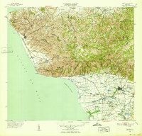
Other maps of this area

1939 · Mayaguez
USGS Topo · 1:30,000

1941 · Rincon
USGS Topo · 1:30,000

1941 · Rincon
USGS Topo · 1:30,000

1947 · Rincon
USGS Topo · 1:30,000

1947 · Rincon
USGS Topo · 1:30,000
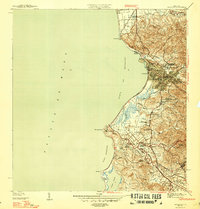
1947 · Mayaguez
USGS Topo · 1:30,000
1949 · Rincon
USGS Topo · 1:30,000
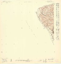
1950 · Rincon ONO
USGS Topo · 1:10,000
1950 · Rincon SE
USGS Topo · 1:10,000
1950 · Rincon NE
USGS Topo · 1:10,000