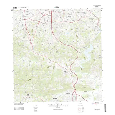
2013 Map of Aguas Buenas
USGS Topo · Published 2013About this map
Aguas Buenas and the surrounding highlands south of San Juan characterize this landscape, where the rugged topography of the Island of Puerto Rico dictates the flow of numerous streams. Tributaries like Quebrada Sonadora and Quebrada de Muertos drain the steep slopes near the Cementerio Municipal Numero Uno, eventually feeding into the larger Rio Grande De Loiza. The transition from urbanized fringes like Boriquen Gardens to the more rural, high-elevation points at Cerro Marquesa and Altos de la Mesa is clearly visible. This 2013 survey illustrates how settlement patterns follow the winding routes and ridgelines, particularly around the northern edges of Caguas and the eastern limits of Guaynabo, where modern development meets the island's interior stream valleys and peaks like Cerro Magueyes.
Find a feature on this map
61 named features on this map. Tap any name to fly to it.
Don’t see what you’re looking for? This feature index may not catch every label — zoom into the map to look around manually.
Map Details
Editions of this 2013 Aguas Buenas Map
This is the sole edition of this map. No revisions or reprints were ever made.
Other maps of this area

1940 · Carolina
USGS Topo · 1:30,000

1941 · Bayamon
USGS Topo · 1:30,000

1941 · San Juan
USGS Topo · 1:30,000

1941 · Carolina
USGS Topo · 1:30,000

1946 · Aguas Buenas
USGS Topo · 1:30,000

1946 · Comerio
USGS Topo · 1:30,000

1946 · Naranjito
USGS Topo · 1:30,000

1946 · Gurabo
USGS Topo · 1:30,000

1946 · Juncos
USGS Topo · 1:30,000

1946 · Caguas
USGS Topo · 1:30,000