
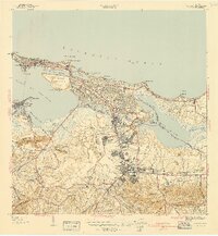
1941 Map of San Juan
USGS Topo · Published 1941About this map
Morro Castle and La Fortaleza anchor the historic defensive posture of this Caribbean port, as seen in this 1941 preliminary survey. The urban expansion of the era is evident in the transition from the old walled city toward developing neighborhoods like Hato Rey and the Barriada Eleanor Roosevelt. To the south, the Universidad de Puerto Rico stands as a focal point of the Municipio de Rio Piedras, while specialized institutions like the Penitenciaria Insular and Sanatorio Insular appear in the outlying terrain. The map captures a critical period of infrastructure growth, showing the intricate network of canals and waterways such as the Caño de San Antonio and Caño Martin Peña that facilitated transport before modern dredging and development significantly altered the shoreline and wetlands surrounding the Laguna San Jose.
Find a feature on this map
87 named features on this map. Tap any name to fly to it.
Don’t see what you’re looking for? This feature index may not catch every label — zoom into the map to look around manually.
Map Details
Editions of this 1941 San Juan Map
2 editions found
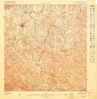
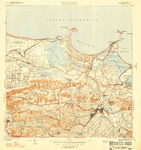
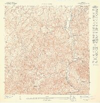
Other maps of this area

1940 · Carolina
USGS Topo · 1:30,000

1941 · Bayamon
USGS Topo · 1:30,000

1941 · Carolina
USGS Topo · 1:30,000

1946 · Aguas Buenas
USGS Topo · 1:30,000

1946 · Naranjito
USGS Topo · 1:30,000

1946 · Gurabo
USGS Topo · 1:30,000

1947 · Carolina
USGS Topo · 1:30,000
1947 · Aguas Buenas NO
USGS Topo · 1:10,000
1947 · Bayamon
USGS Topo · 1:30,000
1947 · Naranjito NE
USGS Topo · 1:10,000
Featured Places
- San Juan, San Juan
- Cataño, Cataño
- Río Piedras, San Juan
- Los Murieles, San Juan
- Sector La Palmita, San Juan