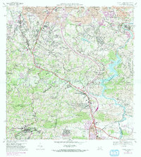
1969 Map of Aguas Buenas
USGS Topo · Published 1982About this map
The hills of Aguas Buenas and the surrounding municipalities of Guaynabo and Trujillo Alto reveal a landscape transitioning from rural coffee and agricultural sectors to urban expansion in the late 1960s. A dense concentration of telecommunications infrastructure is evident on the heights of Cerro Marquesa, where multiple broadcast towers including Antena de Radio (WKAQ-TV) and Antena de Radio (WIPR-TV) occupy the strategic high ground south of Hato Nuevo.
Find a feature on this map
134 named features on this map. Tap any name to fly to it.
Don’t see what you’re looking for? This feature index may not catch every label — zoom into the map to look around manually.
Map Details
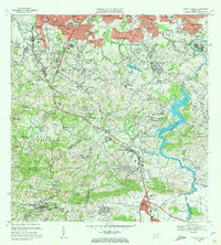
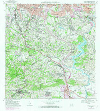
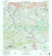
Editions of this 1969 Aguas Buenas Map
4 editions found
Other maps of this area

1940 · Carolina
USGS Topo · 1:30,000

1941 · Bayamon
USGS Topo · 1:30,000

1941 · San Juan
USGS Topo · 1:30,000

1941 · Carolina
USGS Topo · 1:30,000

1946 · Aguas Buenas
USGS Topo · 1:30,000

1946 · Comerio
USGS Topo · 1:30,000

1946 · Naranjito
USGS Topo · 1:30,000

1946 · Gurabo
USGS Topo · 1:30,000

1946 · Juncos
USGS Topo · 1:30,000

1946 · Caguas
USGS Topo · 1:30,000
Featured Places
- Guaynabo, Guaynabo
- Trujillo Alto, Trujillo Alto
- Aguas Buenas, Aguas Buenas
- Sector Pizarro, Guaynabo
- Sector Pueblo Santo, Guaynabo