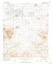
1962 Map of Aguila
USGS Topo · Published 1964About this map
The Atchison Topeka and Santa Fe railroad serves as the central artery for this desert landscape, passing directly through the community of Aguila. This 1962 field-checked survey reveals an economy and geography defined by water management and mineral extraction. A network of livestock tanks, such as Forepaugh Tank and Red Hills Tank, are scattered across the valley, supporting ranching operations like the Eagle Eye Ranch.
Find a feature on this map
47 named features on this map. Tap any name to fly to it.
Don’t see what you’re looking for? This feature index may not catch every label — zoom into the map to look around manually.
Map Details
Editions of this 1962 Aguila Map
2 editions found
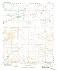
Other maps of this area

1887 · Prescott
USGS Topo · 1:250,000

1892 · Prescott
USGS Topo · 1:250,000

1903 · Congress
USGS Topo · 1:125,000

1904 · Congress
USGS Topo · 1:125,000

1923 · Signal
USGS Topo · 1:250,000

1942 · Signal
USGS Topo · 1:250,000

1942 · Vicksburg
USGS Topo · 1:250,000

1950 · Prescott
USGS Topo · 1:250,000

1954 · Prescott
USGS Topo · 1:250,000

1954 · Phoenix
USGS Topo · 1:250,000