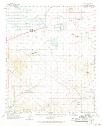
1962 Map of Aguila
USGS Topo · Published 1968About this map
Aguila serves as the primary hub of this high-desert basin, situated along the Atchison Topeka and Santa Fe Railway and surrounded by the Aguila Valley. The landscape is defined by its mining and milling operations, with several remote claims tucked into the southern mountain ranges. To the south, the Big Horn Mountains and Harquahala Mts house operations like the Black Nugget Mine and the Purple Pansy Mine, while the Ambrosia Mill sits along Pump Mine Wash. A small Cem is located near Eagle Eye Ranch north of the valley floor. The geography is characterized by seasonal drainage systems, including Centennial Wash and Tiger Wash, which cross the arid terrain of the Hassayampa Plain.
Find a feature on this map
40 named features on this map. Tap any name to fly to it.
Don’t see what you’re looking for? This feature index may not catch every label — zoom into the map to look around manually.
Map Details
Editions of this 1962 Aguila Map
2 editions found
Other maps of this area

1887 · Prescott
USGS Topo · 1:250,000

1892 · Prescott
USGS Topo · 1:250,000

1903 · Congress
USGS Topo · 1:125,000

1904 · Congress
USGS Topo · 1:125,000

1923 · Signal
USGS Topo · 1:250,000

1942 · Signal
USGS Topo · 1:250,000

1942 · Vicksburg
USGS Topo · 1:250,000

1950 · Prescott
USGS Topo · 1:250,000

1954 · Prescott
USGS Topo · 1:250,000

1954 · Phoenix
USGS Topo · 1:250,000