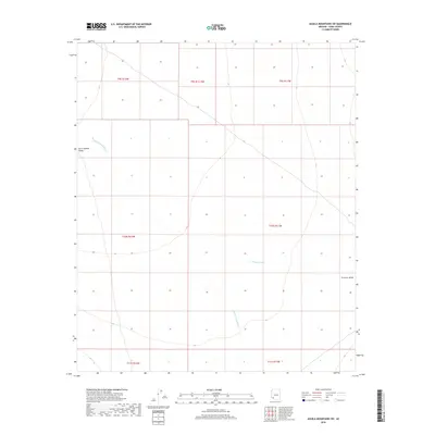
2018 Map of Aguila Mountains SW
USGS Topo · Published 2018About this map
San Cristobal Valley and Growler Valley define the arid landscape of Yuma County in this 2018 survey. The map depicts a region largely dominated by natural drainage systems and vast open basins, where the ephemeral San Cristobal Wash and Growler Wash serve as the primary topographic markers. This desert terrain is organized by the Public Land Survey System, with township and range boundaries such as t10s r11w and t9s r12w providing the only human-imposed structure on an otherwise undeveloped expanse. The lack of built infrastructure or named settlements highlights the remote character of this corner of the Arizona desert, offering a clear view of the natural watercourses and valleys as they appeared in the early 21st century.
Find a feature on this map
11 named features on this map. Tap any name to fly to it.
Don’t see what you’re looking for? This feature index may not catch every label — zoom into the map to look around manually.
Map Details
Editions of this 2018 Aguila Mountains SW Map
This is the sole edition of this map. No revisions or reprints were ever made.
Other maps of this area

1927 · Aguila Mountains
USGS Topo · 1:48,000

1927 · Kim
USGS Topo · 1:62,500

1930 · Aguila Mountains
USGS Topo · 1:62,500

1931 · Kim
USGS Topo · 1:62,500

1953 · Ajo
USGS Topo · 1:250,000

1957 · Ajo
USGS Topo · 1:250,000

1958 · Ajo
USGS Topo · 1:250,000

1962 · Ajo
USGS Topo · 1:250,000

1963 · Ajo
USGS Topo · 1:250,000
1965 · Aguila Mountains
USGS Topo · 1:62,500