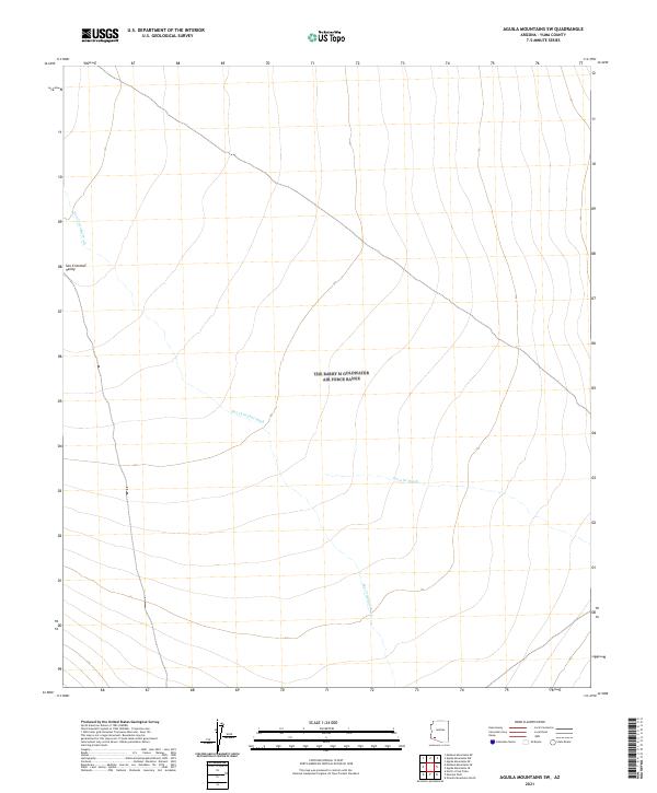
2021 Map of Aguila Mountains SW
USGS Topo · Published 2021About this map
San Cristobal Valley dominates this arid landscape in Yuma County, characterized by its wide, open desert floor and critical ephemeral drainage systems. The San Cristobal Wash trends northwest across the terrain, serving as a primary hydrological feature in an area defined by low relief and expansive desert basins. To the east, the Growler Wash meanders through the flats, illustrating the subtle natural drainage patterns that have historically shaped movement and survival in this portion of the Sonoran Desert. Mapping from the U.S. Geological Survey shows a landscape nearly devoid of modern development, preserved as a vast expanse of public land divided into the traditional township and range grid. The absence of roads or structures highlights the remote nature of this valley, where the primary geographical interests remain the seasonal watercourses and the natural topography of the desert floor.
Find a feature on this map
10 named features on this map. Tap any name to fly to it.
Don’t see what you’re looking for? This feature index may not catch every label — zoom into the map to look around manually.
Map Details
Editions of this 2021 Aguila Mountains SW Map
This is the sole edition of this map. No revisions or reprints were ever made.
Other maps of this area

1927 · Aguila Mountains
USGS Topo · 1:48,000

1927 · Kim
USGS Topo · 1:62,500

1930 · Aguila Mountains
USGS Topo · 1:62,500

1931 · Kim
USGS Topo · 1:62,500

1953 · Ajo
USGS Topo · 1:250,000

1957 · Ajo
USGS Topo · 1:250,000

1958 · Ajo
USGS Topo · 1:250,000

1962 · Ajo
USGS Topo · 1:250,000

1963 · Ajo
USGS Topo · 1:250,000
1965 · Aguila Mountains
USGS Topo · 1:62,500