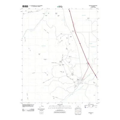
2010 Map of Aguilar
USGS Topo · Published 2010About this map
The town of Aguilar serves as the focal point for this Las Animas County survey, where the Apishapa River flows through a landscape defined by intensive coal mining history. The map records an extensive network of extractive operations, from the Empire Mine and Blazing Rag Mine near the town center to more remote sites like the Las Animas Number Nine Mine and Broadhead Mine tucked into the canyons. Settlement patterns follow the terrain and industrial needs, with Rouse, Rugby, and Lynn positioned along the transportation corridors that historically supported these mining efforts.
Find a feature on this map
59 named features on this map. Tap any name to fly to it.
Don’t see what you’re looking for? This feature index may not catch every label — zoom into the map to look around manually.
Map Details
Editions of this 2010 Aguilar Map
This is the sole edition of this map. No revisions or reprints were ever made.
Other maps of this area

1891 · Walsenburg
USGS Topo · 1:125,000

1891 · Spanish Peaks
USGS Topo · 1:125,000

1893 · Spanish Peaks
USGS Topo · 1:125,000

1894 · Walsenburg
USGS Topo · 1:125,000

1895 · Spanish Peaks
USGS Topo · 1:125,000

1897 · Walsenburg
USGS Topo · 1:125,000

1897 · Spanish Peaks
USGS Topo · 1:125,000

1900 · Spanish Peaks
USGS Topo · 1:125,000

1900 · Walsenburg
USGS Topo · 1:125,000

1954 · Trinidad
USGS Topo · 1:250,000